Project Description
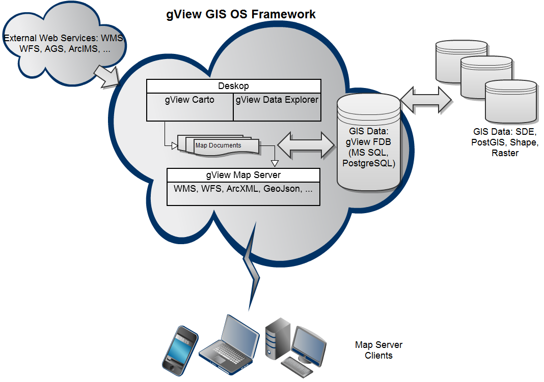
gView GIS OS is a user-friendly open source GI framework for visualizing and managing spatial data (geodata). The entire framework is programmed in .NET (C#) and can be programmed with all. NET languages to expand plug-ins. The spectrum of these extensions includes custom tools, renderers for display of map objects, symbols, data sources for vector and raster data and interfaces to export the card on the gView Map Server. In addition to displaying the data the framework supports a lot more gview GIS features such as layer control, legend layout, and relevant spatial queries, topic marking (labeling) to measure distances and areas, and much more.
Features
Features
- Reading popular vector and raster formats including ESRI shapefiles, ArcSDE, Postgre SQL, and raster formats including MrSid, JPEG2000, ...
- Zoom in / out, pan
- Free adjustable scale for viewing and printingAdding, removing, and sorting of layers
- Changing the look (color, style, fill, outline, symbols, transparency, etc.) for vector data layers
- Transparent raster data layerThematic maps based on vector attribute information
- Property-related data query using query editor
- Measure distances, areas and angles
- Conjunction with external GPS receivers via Bluetooth to display and record the position
- Representation composed of labels and topics of the texts of several attribute fields
- Presentation of factual data in tabular form
- Selection of data due to physical and / or attribute queries
- Redlining functionality (lines, circles, text, points, polylines, polygons) and transaction data storage in the map documents Several maps and data tables in a map document